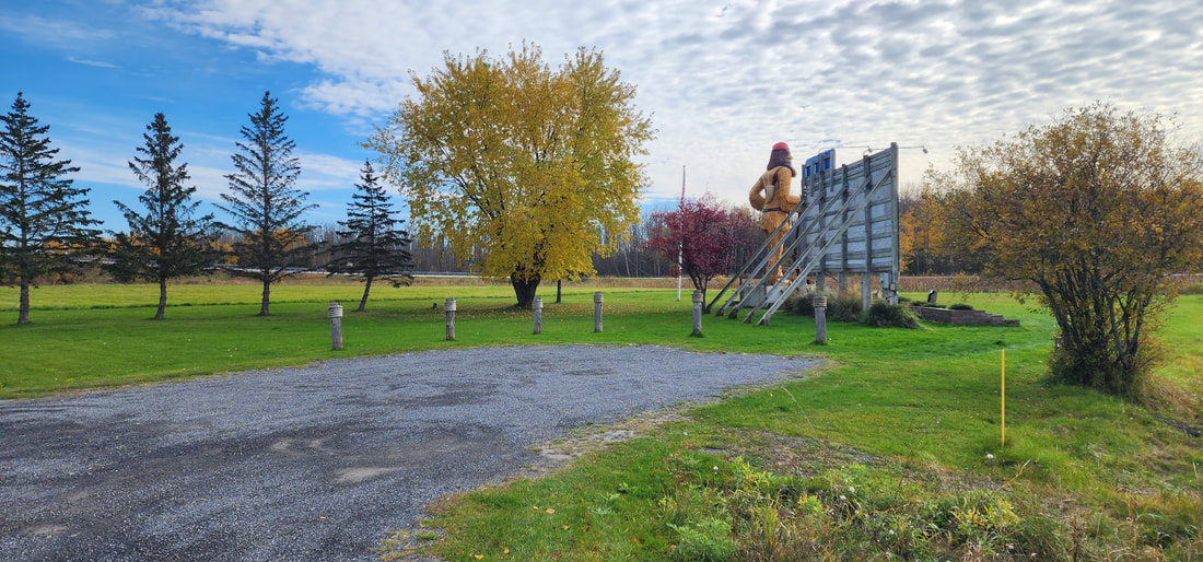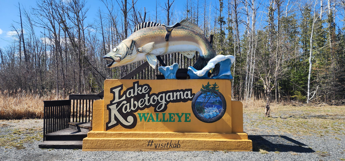
About the Lake Kabetogama WalleyeWilly the Walleye, as the locals refer to it, is located across from the Gateway General Store. It is the first thing you see on the way to Lake Kabetogama. The stairs make it easy to snap a picture of a family member riding it.
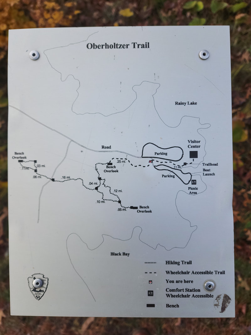
Map
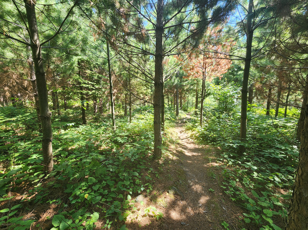
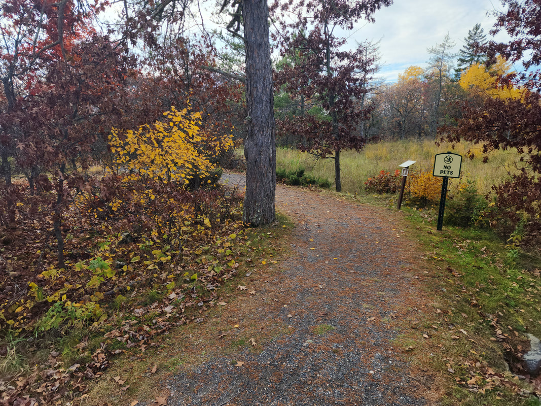
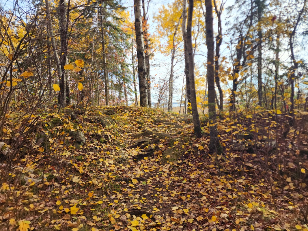
About Ellsworth Rock GardenThe Gardens’ Creation: The Ellsworth Rock Gardens, known as the “Showplace of Lake Kabetogama” since the 1940s, were created by Jack Ellsworth, a self-taught artist and carpenter from Chicago1. Over two decades, he constructed 62 terraced flower beds filled with over 13,000 lilies and other flowers, and adorned the landscape with more than 200 abstract rock sculptures, drawing comparisons to modern sculptors like Noguchi and Brancusi2.
Decline and Restoration: After Ellsworth’s departure in 1965 and subsequent passing in 1974, the gardens fell into disrepair3. However, the National Park Service acquired the property in 1978 and has since organized annual “Garden Blitz” events, involving contractors and volunteers to clear vegetation, replant historic plants, and repair sculptures, thus revitalizing the gardens and preserving Ellsworth’s vision4. Design and Features: The gardens’ design was inspired by the natural topography of the site, featuring meandering paths, small ponds, and a variety of sculptures that range from simple rock formations to elaborate tables and figures. Despite the loss of some original structures and sculptures, the gardens remain a coherent expression of Ellsworth’s artistic legacy, with ongoing efforts to maintain and restore this historic site. Map(Only Accessible by Boat)
Gallery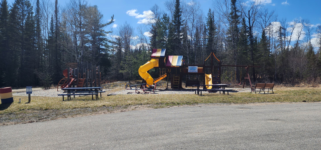
AmenitiesMap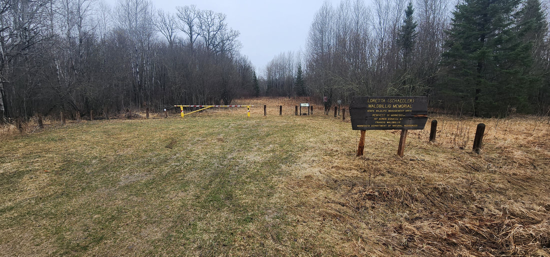
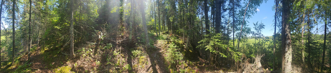
About the Waldbillig WMAThis 190-acre Wildlife Management Area (WMA) borders the Big Fork River and mainly consists of diverse forest types. The majority of the hardwood trees are young, whereas the conifer trees are approaching maturity. The management goal is to preserve the variety of forest habitats.
The Waldbillig family donated the land for this WMA. Access from the county road is easy, and signs mark the area. Owner: Minnesota Department of Natural Resources

AmenitiesGrass parking area
Map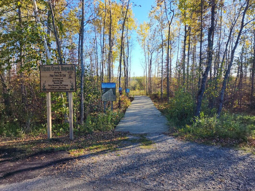
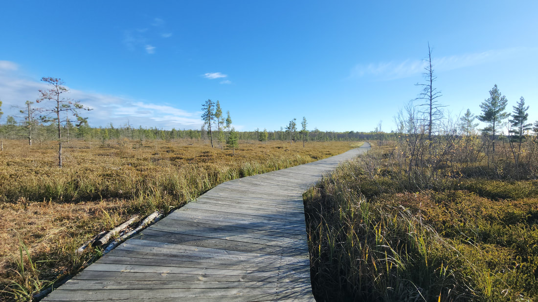
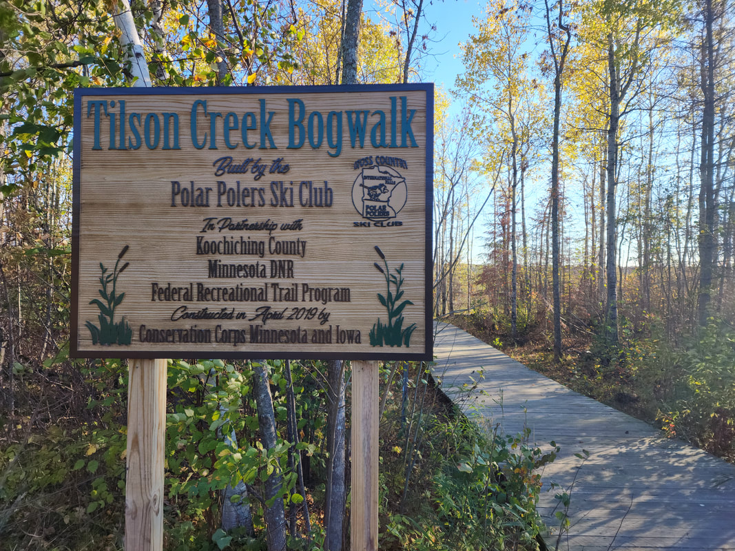
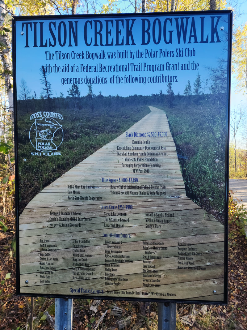
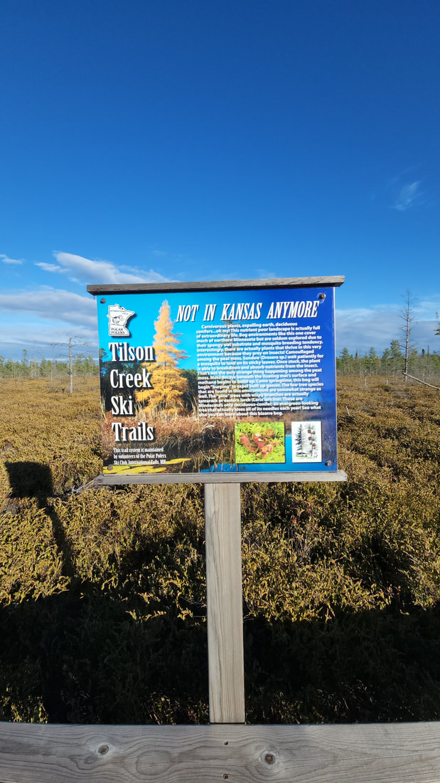
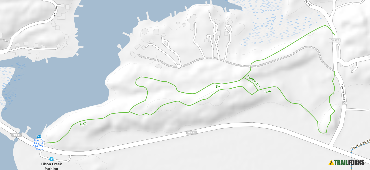
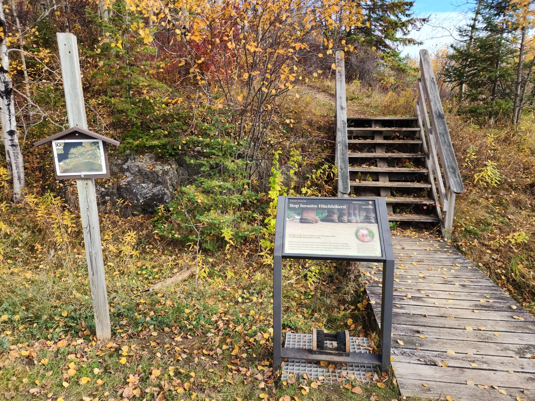
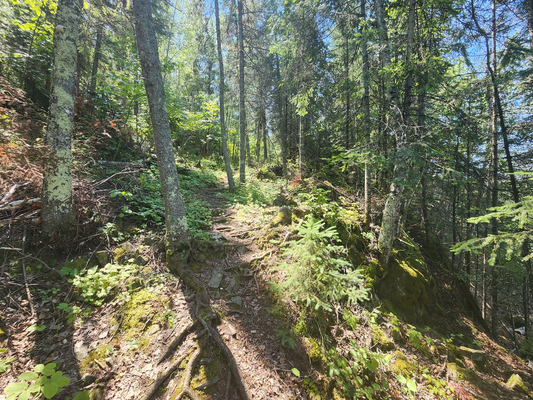
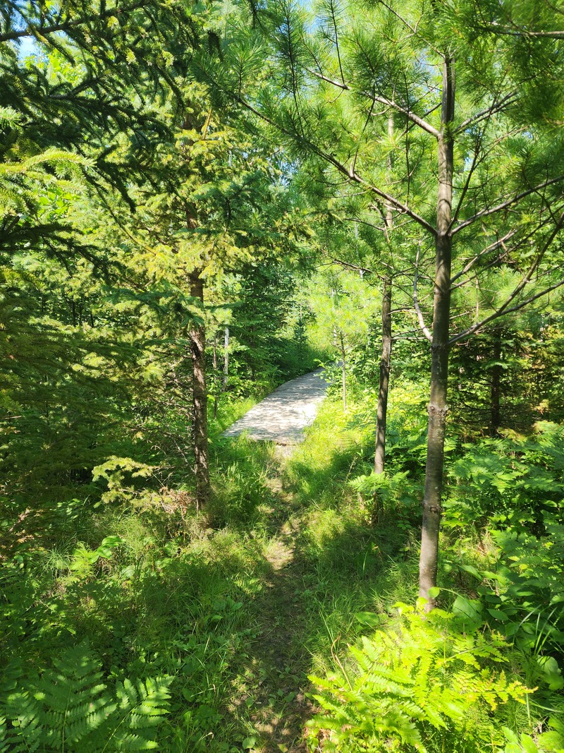
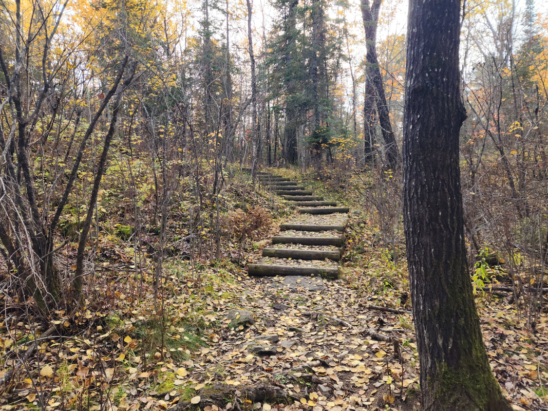
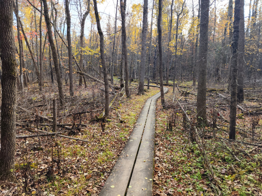
About the BogwalkThe Tilson Creek Bogwalk is the beautiful destination during all four seasons.
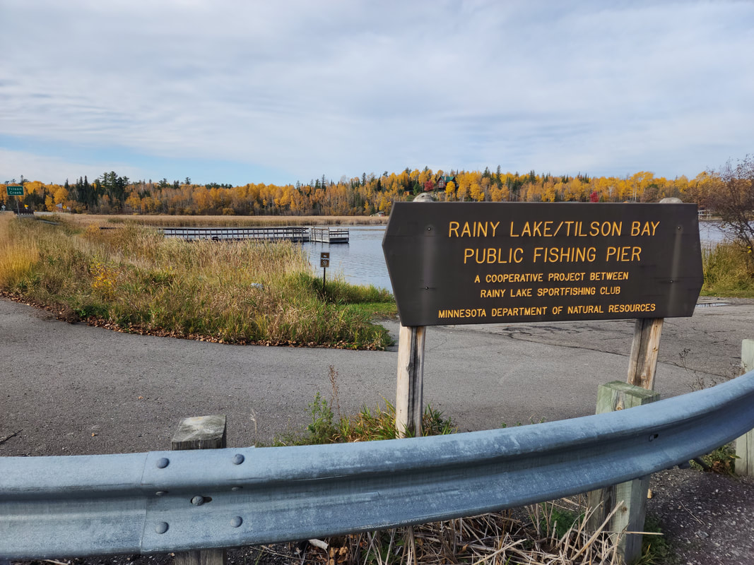
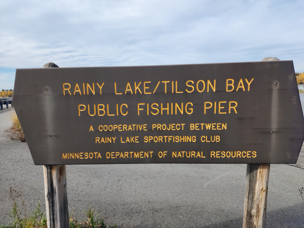
Located near the Rainy Lake public fishing pier on Highway 11 East of Ranier, this half-mile long walkway takes you through a fascinating bog ecosystem that supports a variety of plants and animals. You will see the distinctive tamarack trees, which shed their needles every fall, and the carnivorous plants that trap insects with their sticky leaves. You will also experience the sensation of walking on a floating sidewalk, as the walkway is made from boards that rest on the peat moss below. The Tilson Creek Bogwalk is suitable for all ages and abilities, as it is wide enough for runners, walkers, and strollers. There is also a resting spot at the halfway point where you can enjoy the views and sounds of nature. The bogwalk is part of the Tilson Ski Trail system, which offers more opportunities for hiking and skiing in the pine and spruce forest. Whether you are looking for a relaxing stroll or an adventurous hike, the Tilson Creek Bogwalk will delight you with its beauty and diversity. The Bogwalk is located on Tilson Bay. Tilson Bay is also home to a public fishing dock, public boat ramp, and a hiking trail with an overlook.
MapLattitude 48.598097, Longitude -93.233296
View in Google Maps
Gallery
Videos
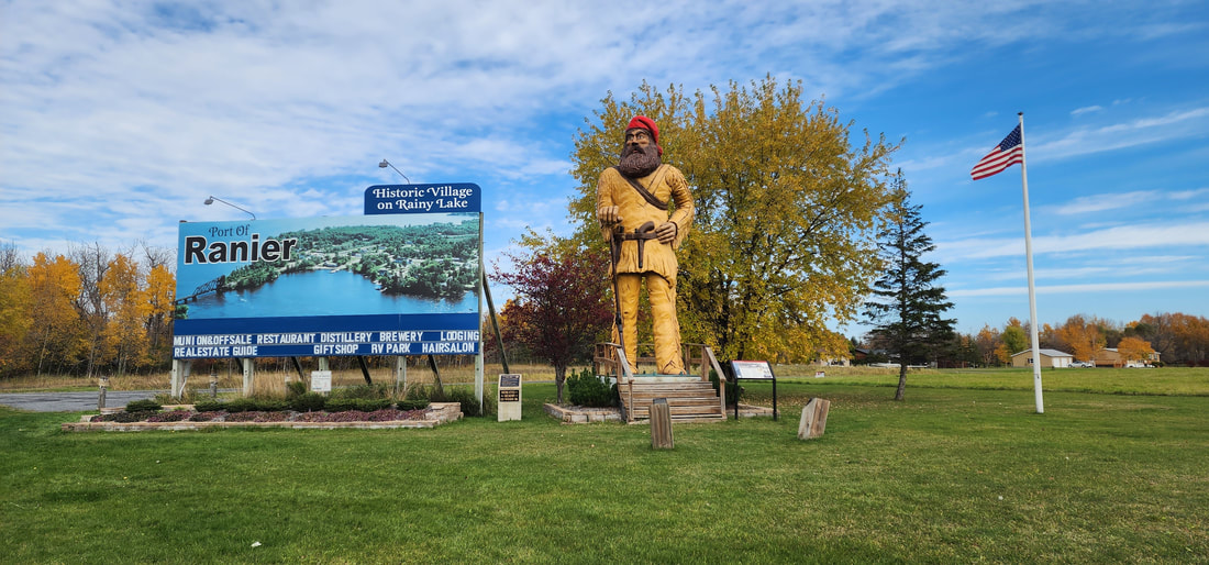
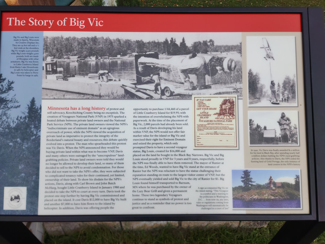
About Big VicThe story of Big Vic is that of protest and self-advocacy in Minnesota, particularly in Koochiching County, ignited by the creation of Voyageurs National Park (VNP) in 1975. The National Park Service's (NPS) use of eminent domain to acquire private land sparked outrage among landowners. Vic Davis, a significant figure in the protest, alongside others, resisted the NPS’s “unscrupulous” land-grabbing policies. Davis, Carl Brown, and John Butch McHarg even purchased Little Cranberry Island and confronted the NPS legally.
Vic Davis intensified the protest by commissioning the Big Vic statue, a symbol of defiance against the NPS. The statue, costing $19,000 for construction and placement, was erected on Little Cranberry Island. Davis also offered parcels of the island for sale to the public, aiming to inundate the NPS with paperwork. However, the NPS seized the property through eminent domain, undeterred by Davis’s efforts. In response, Davis commissioned a second statue, Big Louie, amplifying the protest. The NPS eventually removed both statues, but Big Vic found a new home at the entrance of Ranier after the city purchased it for $1. Big Louie was relocated to Barnum, MN. These statues, symbols of protest and justice, continue to remind the public of the power struggle between private citizens and governmental authority. The enduring presence of Big Vic and Big Louie attests to the indomitable spirit of those who challenged the NPS’s overreach, embodying a historical narrative of resistance and advocacy. Gallery
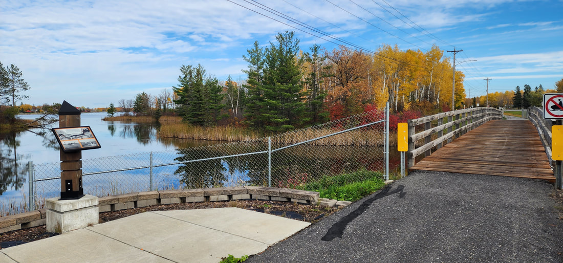
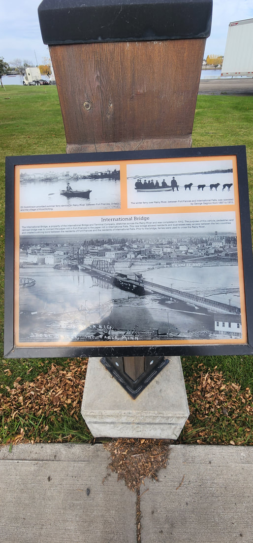
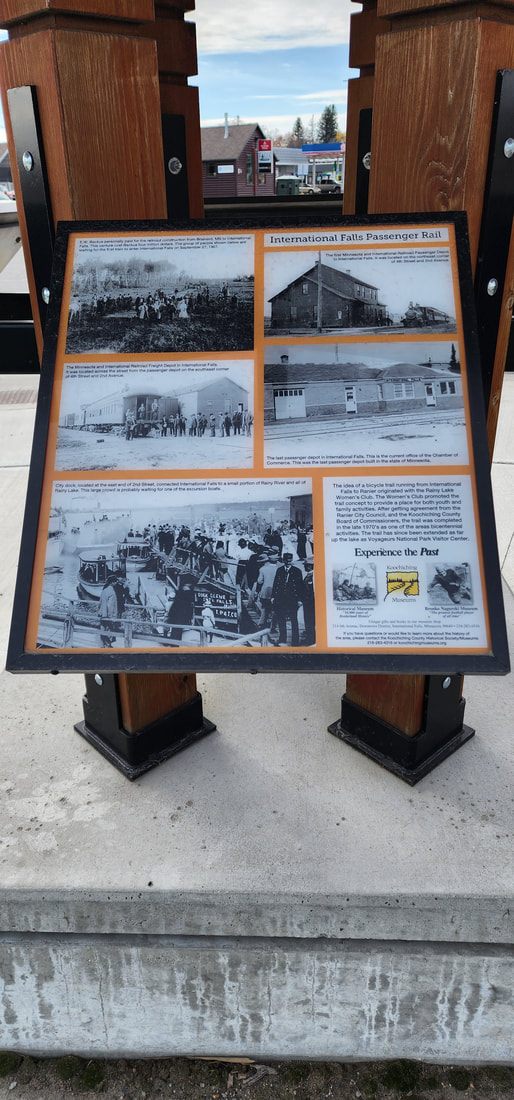
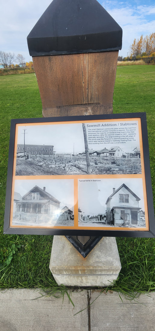
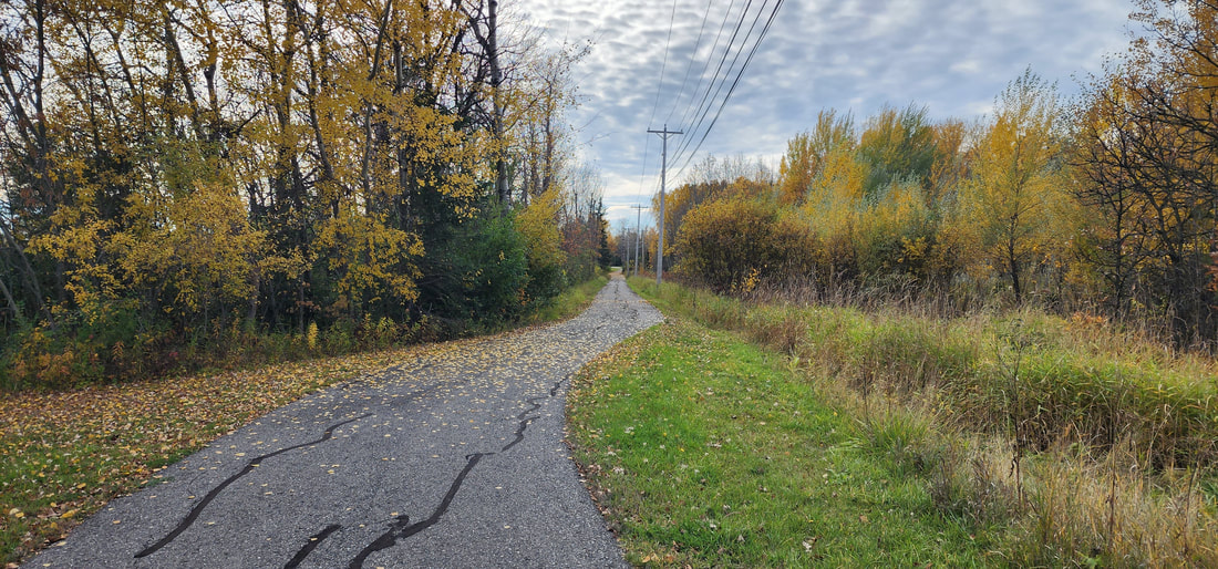
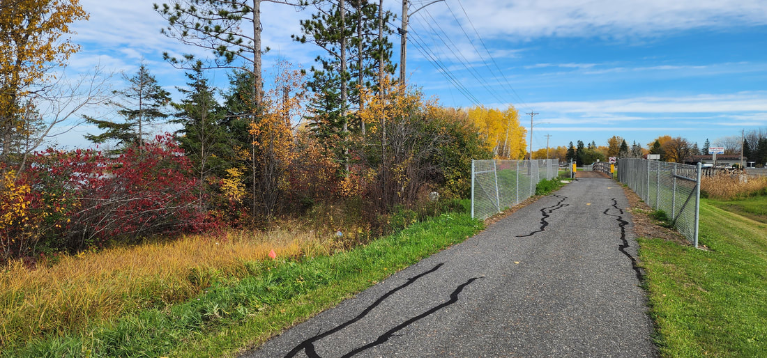
Trail InformationSuitable for biking, jogging, walking.
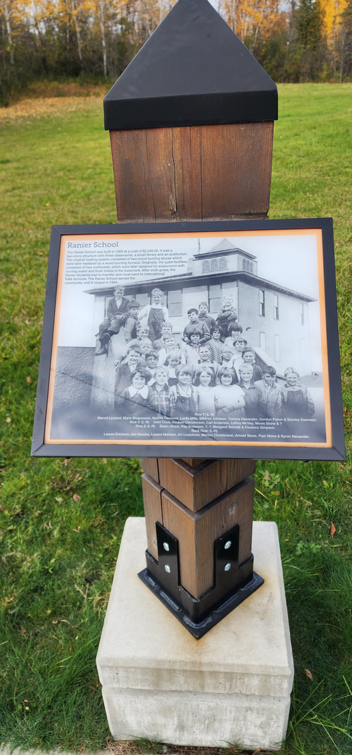
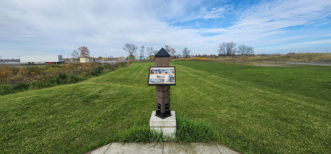
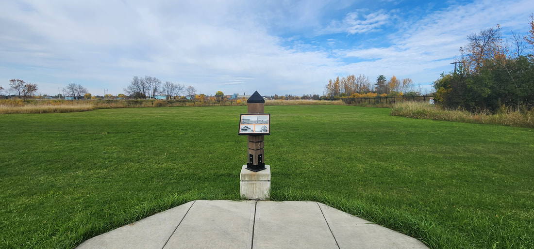
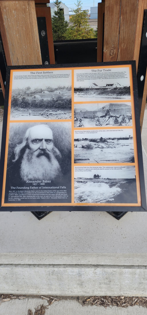
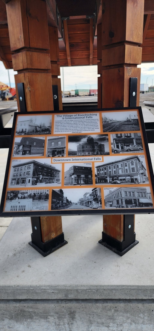
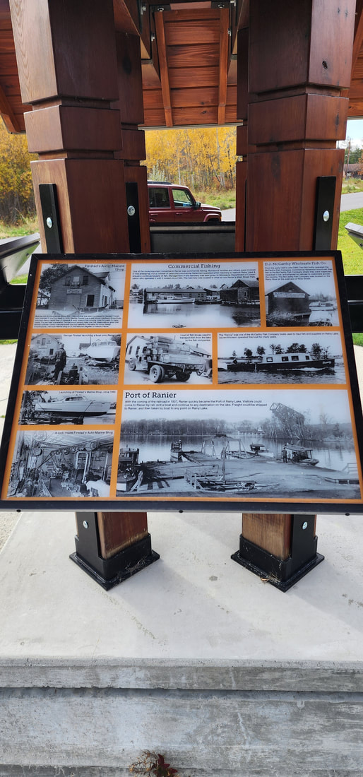
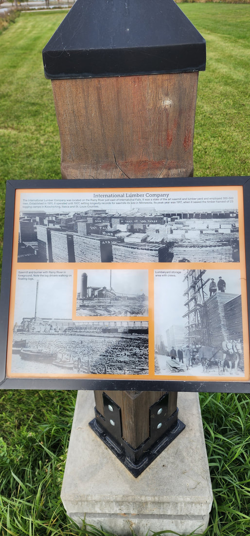
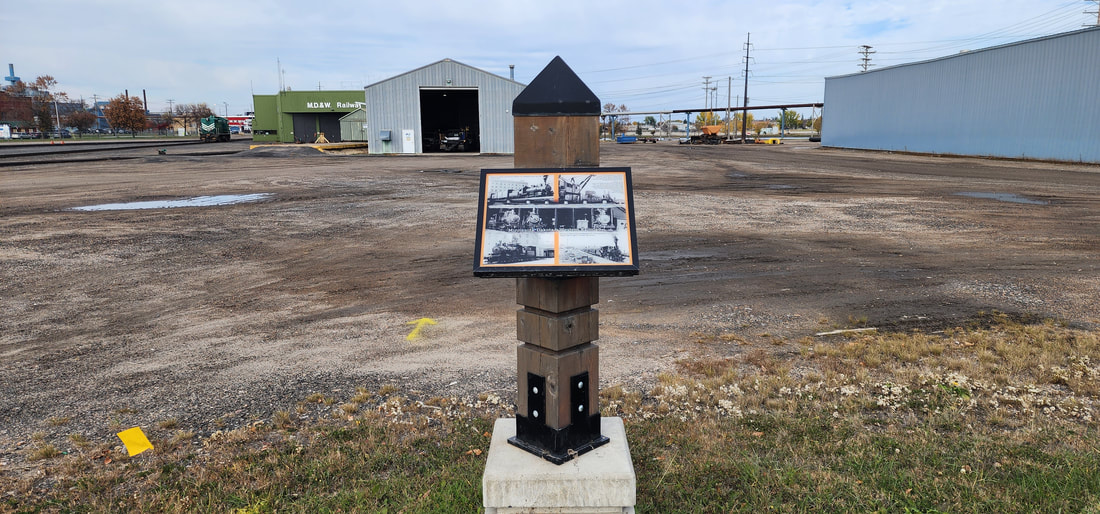
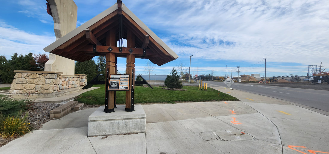
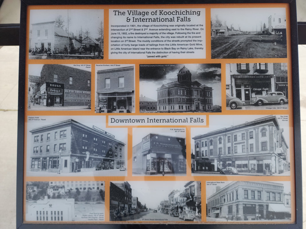
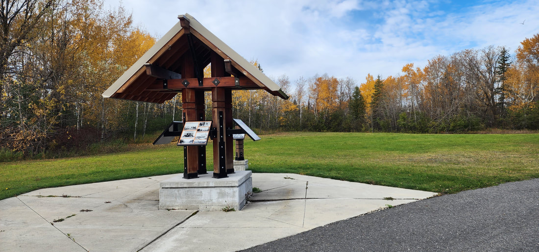
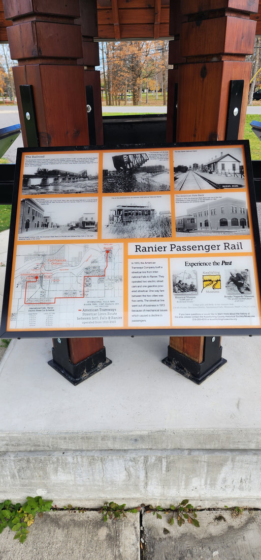
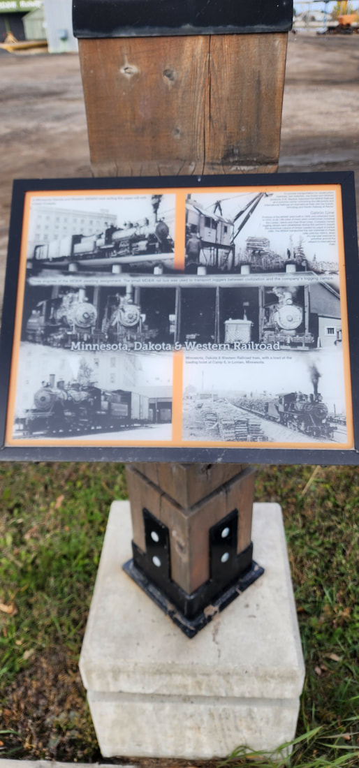
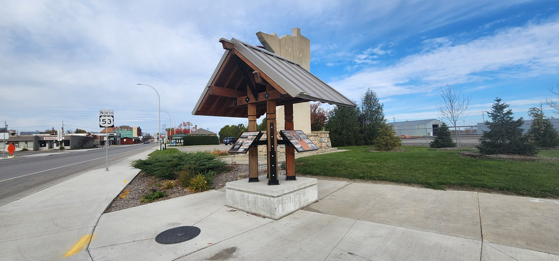
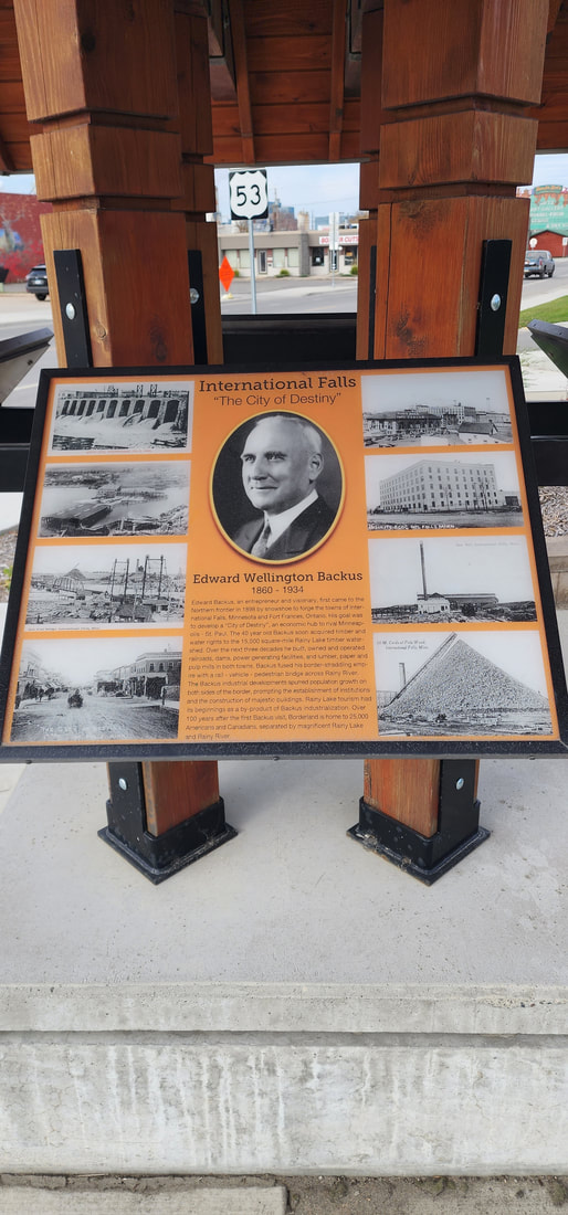
Paved surface with enough room for riding bikes side by side. Starts by the IFalls Chamber of Commerce in International Falls and ends across from Ranier Park in Ranier. Pets are allowed with leash. Passes by the Voyagers National Park Headquarters building and the Pat Roche Landing. Along the way you will find Kiosks with information about notable buildings from our past and the early days of International Falls and Ranier. Koochiching County is responsible for maintaining the bike path. Trail Map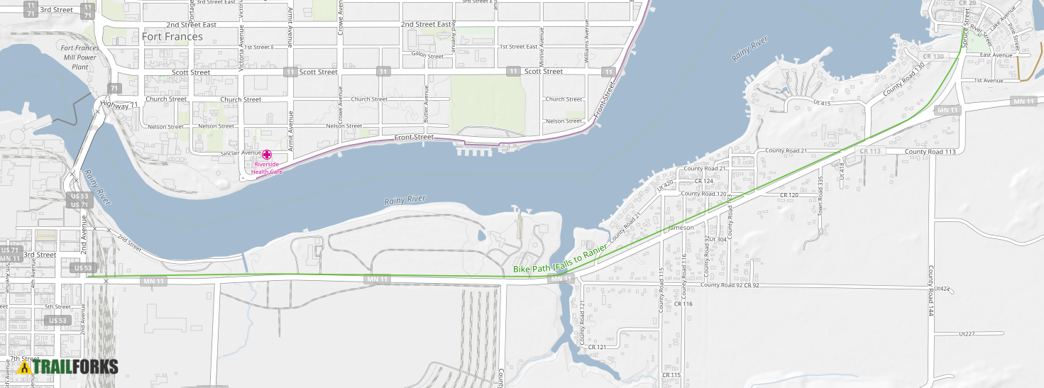
Learn more about this trail by visiting TrailForks.com.
Gallery
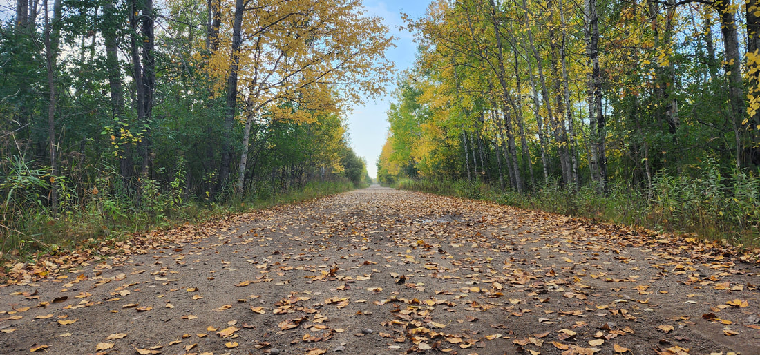
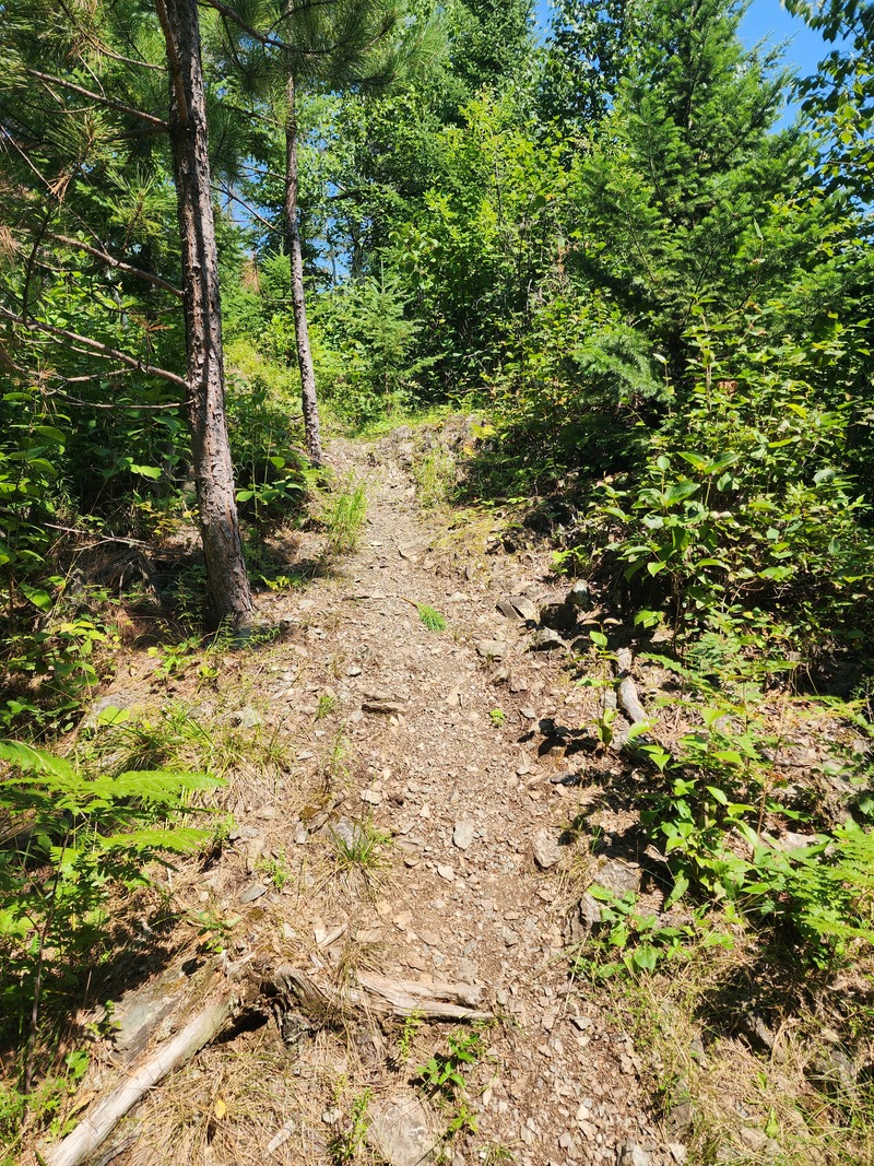
Situated in the north of Minnesota, the Blue Ox Trail spans 74 miles, tracing the path of a disused railway line and offering a smooth, straightforward ride. The journey unfolds amidst landscapes of black spruce, swamps, and aspen uplands, ensuring a picturesque experience in every season. It's a haven for wildlife enthusiasts, with opportunities to spot beavers, eagles, moose, wolves, and bobcats. The trail is a gift from Koochiching County and is meticulously cared for by the Northome Ridge Riders.
Important information: Be sure to follow the detour signs on Highway 71 near the Bigfork River in Big Falls, as a section of the trail is closed from Highway 6 to County Road 31. The trail’s starting and ending points are situated at the northern and southern boundaries of the City of Littlefork, where ATV riding is allowed through the city. Vehicles allowed
ATV (class II allowed) OHMs not allowed on trail south of Funkley and on County Road rights-of-way. 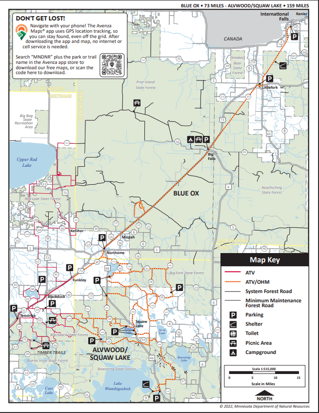
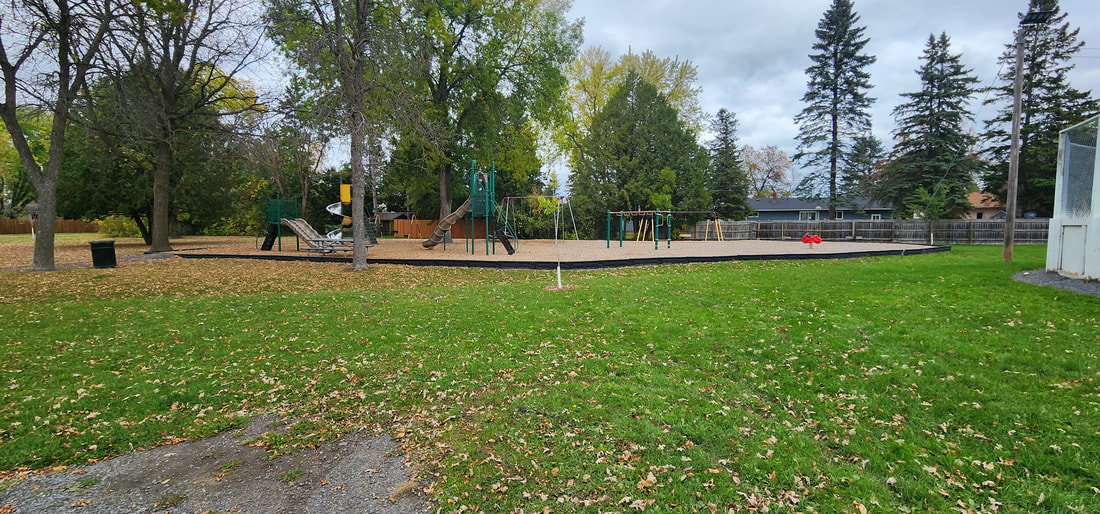
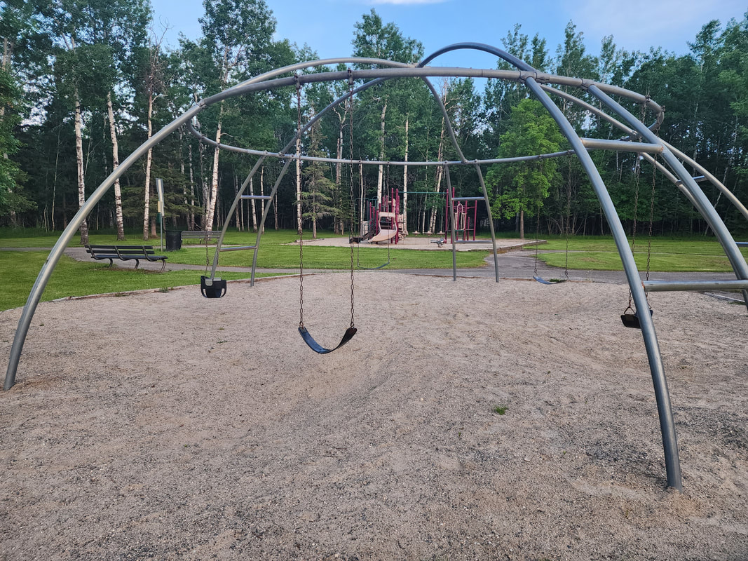
AmenitiesPlayground Equipment
Ice Hockey Rink Skating Rink Warming House Owner: City of International Falls MapGallery
AmenitiesSteep Trails to Rainy River
Dog Poop Bags Bike Rack Owner: City of International Falls MapGallery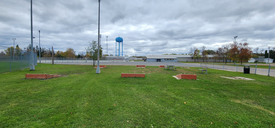
AmenitiesSkate Park
Horseshoe Pits Softball Fields Outdoor Hockey Rink Indoor Hockey Arena Playground Equipment Porta-potty Owner: City of International Falls MapGallery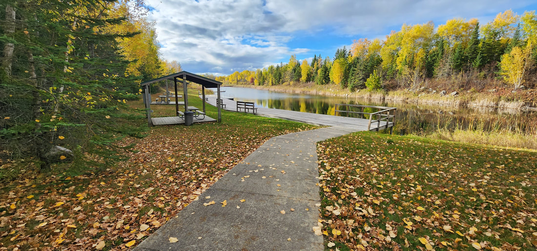
AmenitiesKid's Fishing Pond
Picnic Tables Pavilions (electric) Docks Owner: Rainy Lake Sports Fishing Club/ Koochiching County/ MN DNR MapGallery        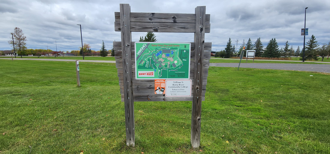
Amenities18 Hole Disk Golf Course
Owner: MN North College - Rainy River MapGallery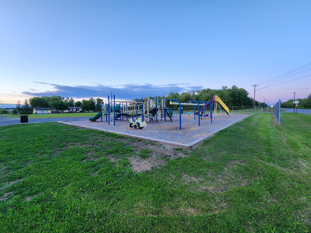
AmenitiesMapGallery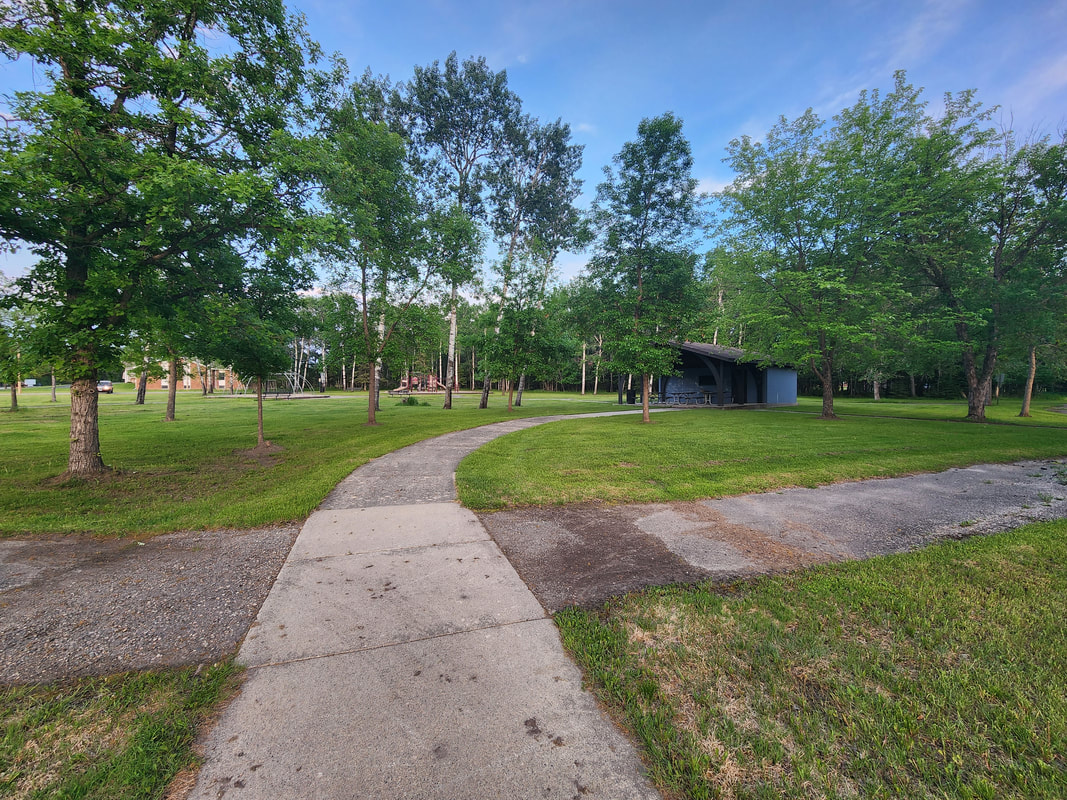
AmenitiesPlayground Equipment
Pavillion Picnic Tables Book Box Located Near Ron Hall Memorial Landing, Rainy River Access Owner: City of International Falls MapGallery
AmenitiesPlayground Equipment
Pavillion Picnic Tables Porta-potty Basketball Court (extra short hoops) Owner: City of International Falls MapGallery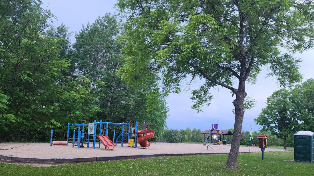
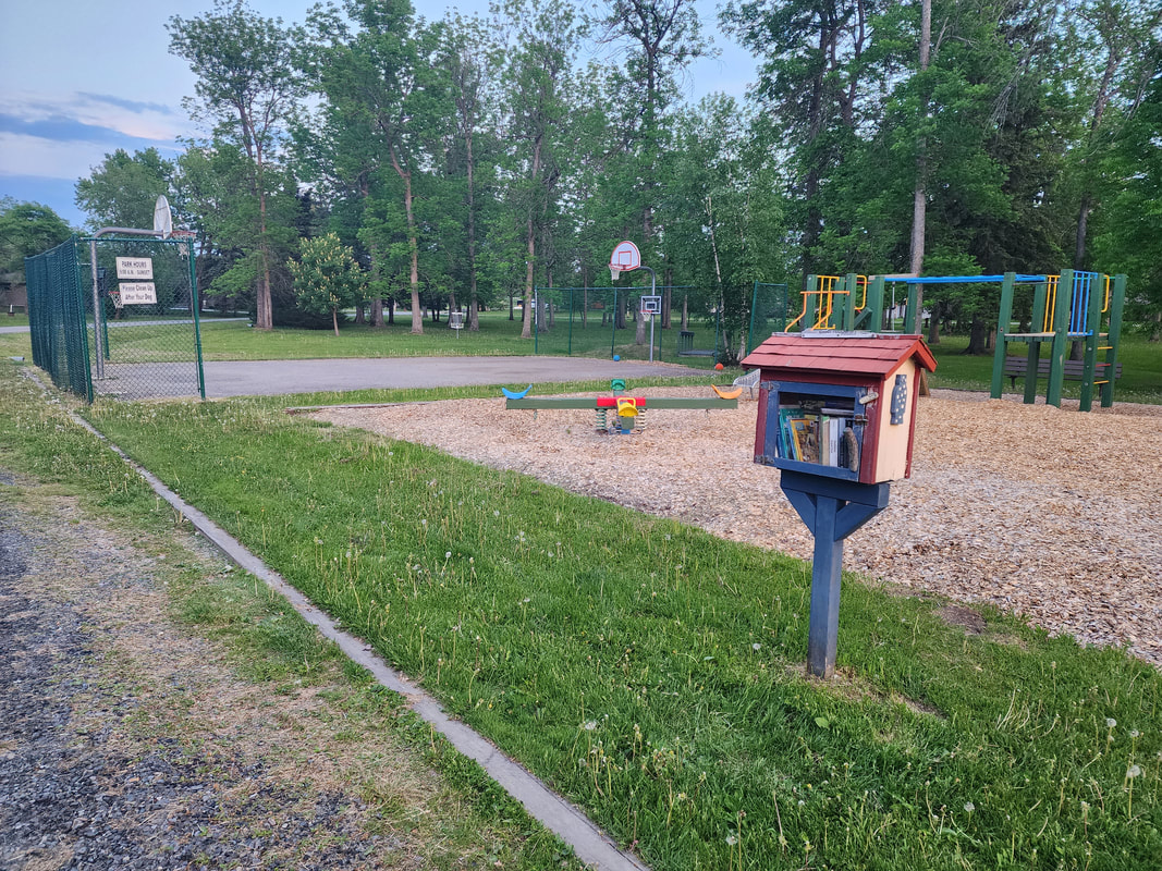
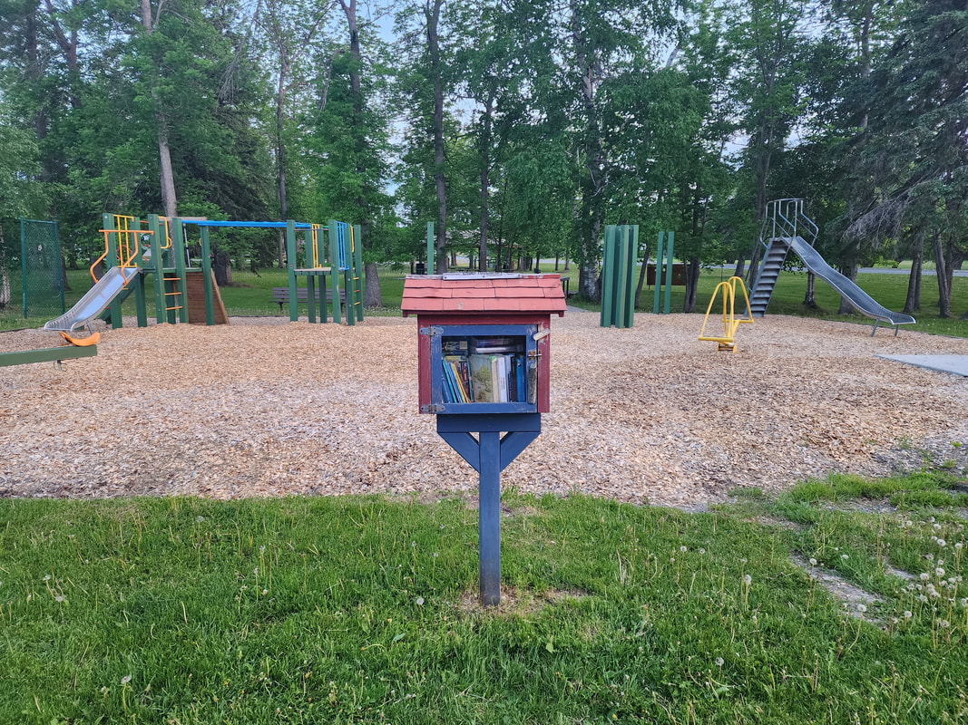
AmenitiesPlayground Equipment
Pavilion Picnic Tables Book Box Porta-potty Located on Rainy River Owner: City of International Falls MapGallery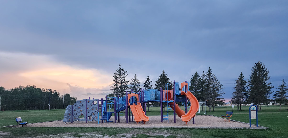
AmenitiesPlayground Equipment (4 structures)
Basketball Hoops Owner: ISD 361 MapGallery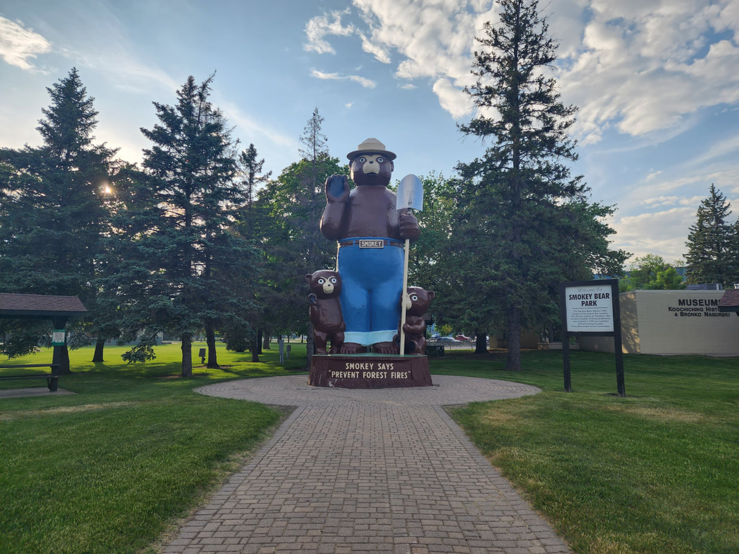
AmenitiesBandshell (concert venue)
Basketball Court Smokey Bear Statue Picnic Shelter Owner: City of International Falls MapGallery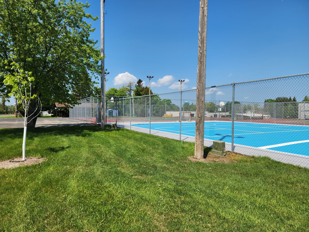
AmenitiesBasketball Court
Tennis Court Roller Hockey Rink Picnic Pavillion Pickle Ball Nets (portable) Porta-potty Owner: City of International Falls MapGallery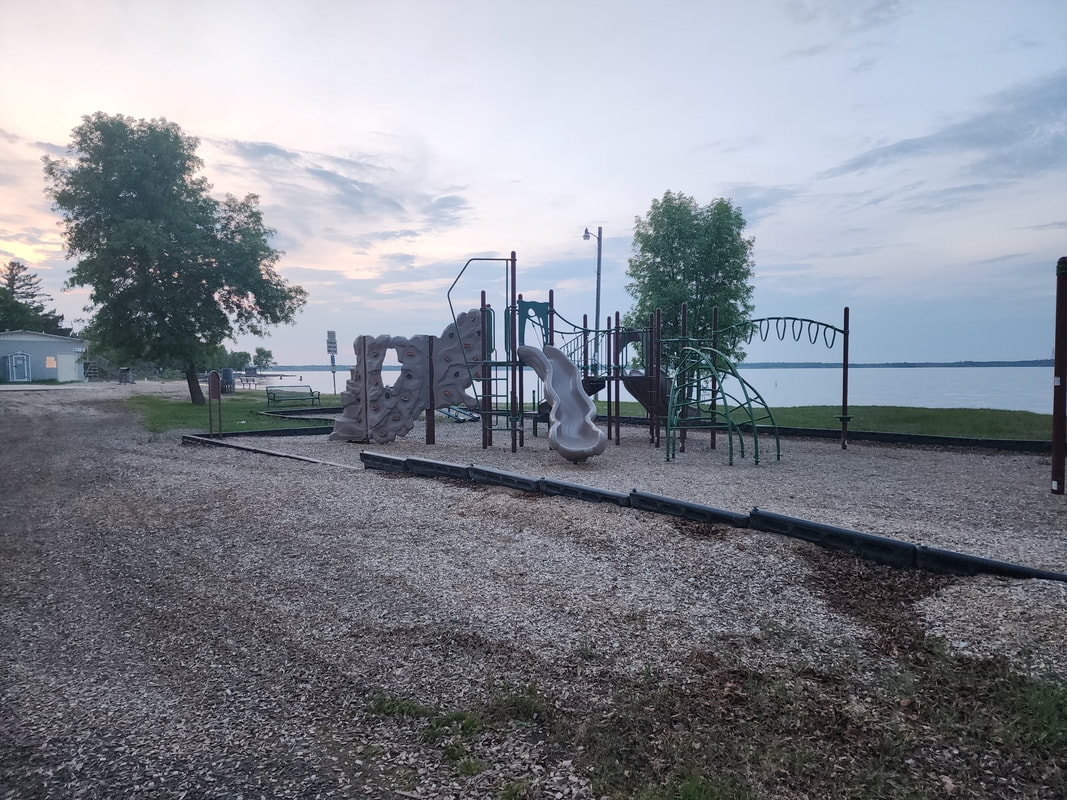
Amenities
2 large parking areas
24 foot by 50 foot covered picnic pavilion 650 feet of sand beach on Rainy Lake 8 outdoor cooking grills Dressing and bathroom facilities Floating swim platform Regulation basketball court Regulation sand volleyball court Swing set and play area Camp Sites - tents only Owner: City of International Falls MapGallery  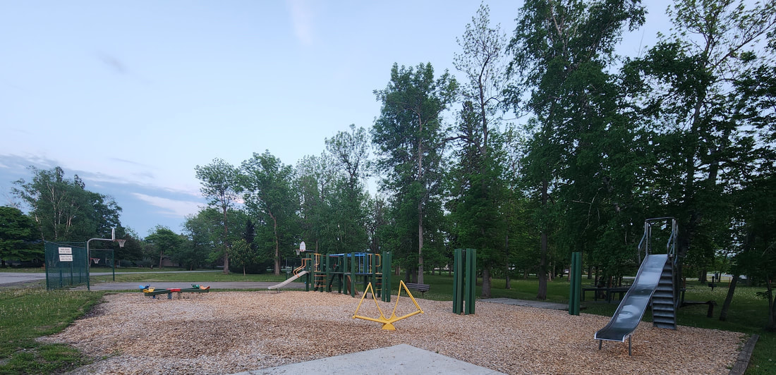
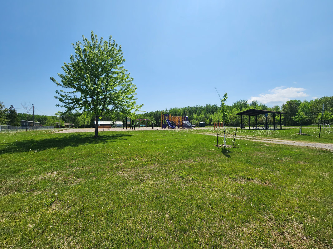
AmenitiesPorta-Potty
Book Box Playground Basketball Court Picnic Pavillion Disc Golf Horseshoe Pits Owner: City of Ranier MapGallery
|